
Have you used a Geo Map in CRM Analytics? Geo Maps are a delightful way to display information that includes an address. They are more granular than the Map object because they let you highlight detail all the way down to the zip code instead of just at the state, while retaining the Bubble Size/Color options of a Bubble map.
For example, Salesforce’s standard Contact object has all the usual address fields out of the box.
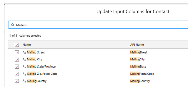
You can also use Other Address, if you prefer.
You can use this information to drop all those contacts on to a map. For example, in our demo database I threw together this map of our Zip Codes in the United States.
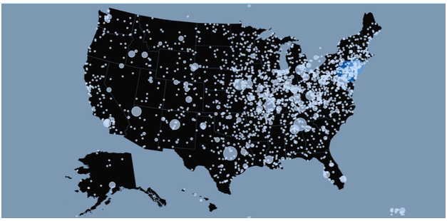
Oh my god, it’s full of stars… I mean, zip codes.
The only part of this that isn’t available right out of the box is mapping the Zip Codes from the Address to the appropriate Latitude/Longitude. You can find publicly available data that does this mapping for you, or you can engage a clever CRM Analytics (CRMA) consultant like Kyni Solutions. Either way, you’ll end up with something like this:
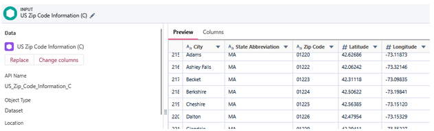
Shout out to our cool friends in Massachusetts
This lets you configure a Geo Map as follows:
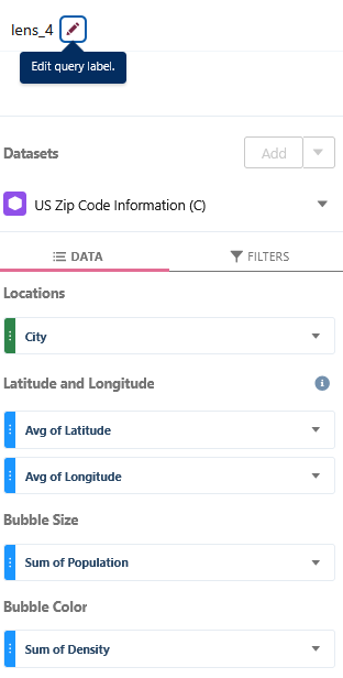
Which in turn gives you a map like the one at the start of the process, which is configured as Map Type = “United States”.
Nice and easy, right? Well, it’s nice and easy if your contacts are all in the United States. What happens if you’re doing business internationally?
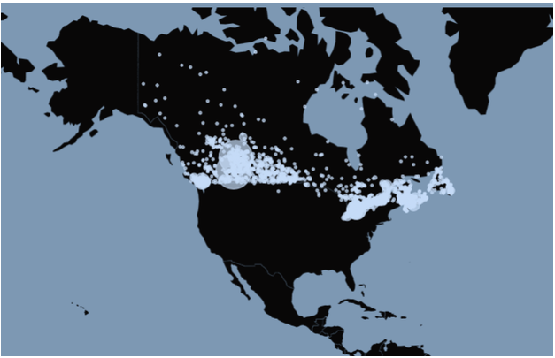
In theory, we should be able to use some of the other Map Type settings to do the same thing for other parts of the world; after all, Latitude and Longitude are global concepts, and mappings of the various international postal codes to Latitude and Longitude can be built. For example, here’s our North American map with contacts from Canada.
Oh my god, it’s full of stars… I mean, zip codes.
So what’s the catch? Well, for Canada, there’s only a North America map option. There is no Canadian map option. Supposedly there’s a way to upload a custom map, but we’ve never been able to get it to work correctly, so if you want Canada this is certainly your easiest option.
What happens if you’ve got 95% United States contacts and 5% Canadian contacts? Do you really want this map of the full continent, most of which isn’t relevant to you? Well, you can do what we did and do some creative geographic to show Canadian contacts on the United States map. Let’s see the output first.
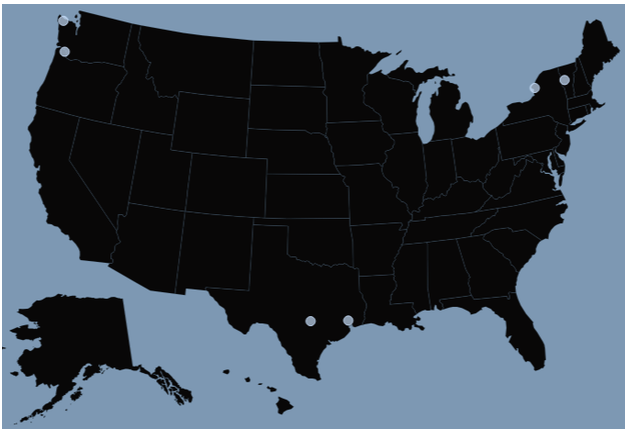
If I mouseover the top middle dot, I get this:
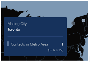
Toronto is clearly not in New York state. What happened here? We found for one of our clients that 99.99% of their Canadian contacts were in the largest Canadian cities, like Vancouver, Toronto and Montreal. Going further, 76% of Canadians live within 100 miles of their southern border, and the big three cities of Montreal, Toronto and Vancouver combined account for 35% of Canadians.
With all this in mind, instead of showing the entire North American map, we used some creative mapping in the recipe to pretend that these major Canadian cities had Latitude/Longitude in the extreme northern United States. We picked some zip codes in mostly empty parts of the United States and pretended they were Canadian cities. Now we could show all of their contacts on the comparatively smaller United States map instead of the enormous North American map.
This solution has some challenges.. For starters, pretty much no Canadian and no geography nerd is going to be happy about this approach. We apologize to our neighbors up north and to Ken Jennings. Second, if you’ve got Contacts all over rural Canada, or even in major cities that are much farther north from the border (shout out to Calgary), it’s going to seem even more ridiculous. However, in the scenario where 95% of your Contacts (or whatever record) are in the U.S. and the rest are in Canada, it works pretty well.
Have a favorite map hack? We’d love to hear it. And if you know how to import a Canadian map and make it work, we’d really love to hear that too.
